| |
|
|
Elk Hunting Information
|
Colorado Dept. of Wildlife- Hunting Information
|
| |
|
|
| View across from top across road |
|
| Click to enlarge |
|
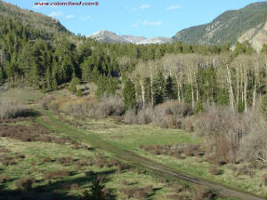
| View from the General Area |
|
| Click to enlarge |
|
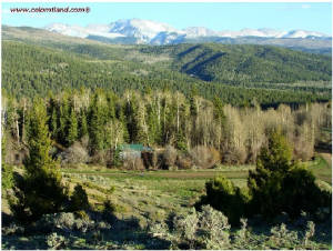
| Trinchera View |
|
| Click to enlarge |
|
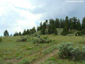
| Showing the neighbor's at top of crest |
|
| Click to enlarge |
|
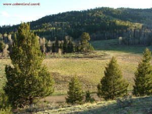
| Meadow view uptop |
|
| Click to enlarge |
|
| Another view of the parcel from above |
|
| Click to enlarge |
|
| |
|
|
SDCR Unit B-3, Block 278, Lot 6281 -- 9,450’ Elevation
-- 5.42 Acres. $15,500 Cash or Fast-Pay( finish paying in 2 years - $6,000 down). $17,000 with longer
term financing. $6,000 down and 55 monthly payments of $200. This lot is accessible from Memorial Day through
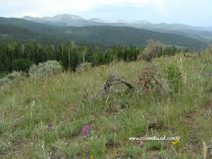
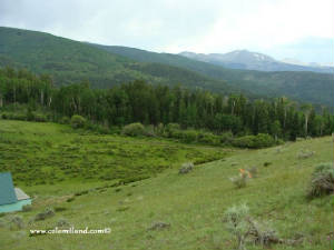
December. It is located in an area with beautiful alpine meadows. This area is a favorite among the locals and there are several
cabins nearby. This parcel has several,
nearly flat areas near the road and can be used for camping immediately. It has a gently sloping, rounded top with a
gorgeous view towards Trinchera Peak and the Sangre De Cristo Mountains south of US 160. The elevation is 9,540'. There is a steep 4-WD road going
to the top of the property. To change that to a 10% grade will require a winding drive about 800' long and estimated
to cost $2,000.
There are
an estimated 60 cabins above 9500’ and people use solar panels for power, septic systems for waste and buried cistern
for water. Propane is used for cooking and heating. Most alpine cabins will also have a wood stove. Propane and water delivery
is available, but owners often haul their own water. Water can be hauled with trailer mounted tank (300-500 gallons) and these
tanks can be filled at the San Luis Water Department. High Country wells are common in Forbes Park, but to my knowledge, there
are none above 9500’ in the SDCR.
Directions to SDCR B.3.6281Please
Note: These directions lead to an alpine parcel above 9,500'. This parcel is not accessible by vehicle with muddy or snowy
roads. Portions of Forbes and Malcolm have a very slippery silty clay surface and it is easy to slide into
the ditch. If these conditions are present, please chain up or forget it. From Fort Garland head south on Colorado Hwy 159 for about
10 miles and after passing Mile Marker #22, turn left at Jasper Road. Take the next right, go 1/4 mile
and turn left at Rito Seco Road. Head east on Rito Seco for about 5 miles, pass some Battle Mountain Gold
Mine buildings on your left. Then turn right on Forbes Road. Forbes Road is the main
road into the high country. Zero odometer as you turn right on Forbes Road and go up the mountain for about
3.8 miles. Turn right at wooden sign "Sangre de Cristo Ranches." Zero odometer
again as you turn right. Take the left fork at the next intersection and after that, take the next left
fork again. Then take the next right and continue on Malcolm for 2.3 miles and stop vehicle at Malcolm
and Jaquez. Lot 6281 will be on your left.
.
|
|
| GPS Coordinates and boundaries |
|
|
| Click to enlarge |
|
|
| |
|
| |
|
| |
|
|
|
|
| |
|
|
|
| |


