|
|
- Five Acre Plus parcels listed in Alphabetical
Order
- Parcels with
power or near power are noted
- Directions
to many of the lots included with their description
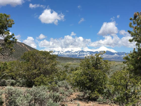
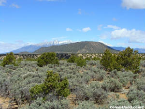
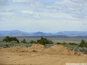
| Mountain Views and Flat terrain |
|
|
|
| From Friend Leland on 3/6/15 |
|
|
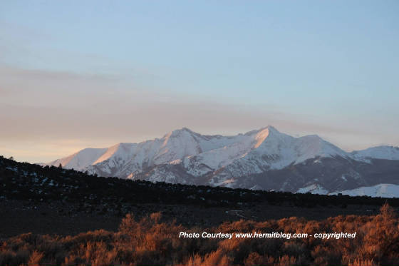
| Sunrise in SDCR - Taken from Unit C |
|
|
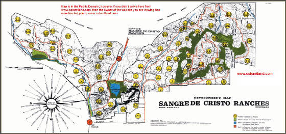
Click on the map shown to the side to see the SDCR area and locate our Sangre
de Cristo Ranch Mountain Land properties for Sale
CLICK- SDCR COVENANTS
Click to view original Forbes Brochure Ad
ALPINE PROPERTY IN THE SDCR - CLICK
CLICK TO SEE OUR APPOINTMENT CALENDAR
|
SDCR has covenants and is designed for residences although 90% of it is open and not settled consisting of some
permanent residences and many camping sites
|
It is required to get permits for building from the county - that includes driveways and septic systems
|
There is no regulation which prohibits camping, although recently the county defined the frequency that
you can camp. Sanitation and open fires are an issue. You must follow the county
regulations |
We urge all prospective buyers to read the covenants thoroughly and be familiar with them. We follow them and
we expect you to also, if you purchase from us!
|
|
While you are purchasing land from us, we do not allow building projects,
living on the land, or storing of equipment, supplies, or vehicles. We do allow short-term camping. All county
Rules and Regulations must be followed regarding camping and permitting. If you get our permission, you can put in a
driveway and/or camping pad, with a permit from the county. There might be a few exceptions, such as keeping a fire-pit
on the property which we can allow on an individual basis.
|
|
| SDCR Map |
|
| CLICK FOR A LARGER FULL SCALE VERSION |
There are approximately 9,000 parcels of land in SDCR. Click this map to see the UNIT
location of land that you might be interested in
|
|
CONTACT US WITH QUESTIONS - Click
|
| |
|
| |
|
| |
|
|
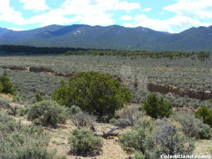
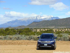
| Looking North towards Mt Lindsey |
|
|
| Click to Enlarge |
|
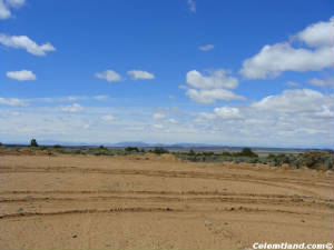
| View from lot to the North East area |
|
|
| Click to Enlarge |
|
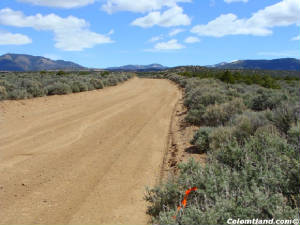
| Wilder Road |
|
|
| Click to Enlarge |
|
| Sunset from area - professional photographer |
|
|
| Click to Enlarge |
|
| Northern view in late winter |
|
|
| Click to Enlarge |
|
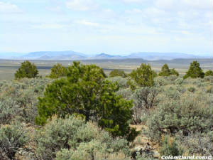
| Looking across parcel from Wilder |
|
|
| Click to Enlarge |
|
|
Take 20% off the
Cash Price for Fall
liquidation sale
|
|
|
Courtesy
Reservation: Tony B. from KY 1-6-2020 SDCR Unit C, Block 65, Lot 657
-- 5.28 Acres -- $5,000 Cash On Wilder Road, just
a turn off Slegers, this parcel is easily accessible year round and not far from town. It is near a great neighbor and
his famous dogs and can be an off grid home-site, but with a septic, power source and a cistern. Solar is the way to
go. It would be ready to camp on with a little clearing of the brush and a driveway and pad. There is a
partial view of the mountains, and it is sheltered from the north with the CAT mountain. It is very near the Mountain
Home Reservoir for fishing, boating, kayaking, and camping in the summer and early fall. It is flat and has no real
trees but the little stream that flows down this area does trickle a bit and some properly planted tree shoots would grow
if watered and nurtured.
| Plat Map |
|
|
| Click to Enlarge |
|
| |
|
| |
|
| |
|
|
| Blanca Massif from Leonard Rd. |
|
| Click for larger picture |
|
| Looking up Leonard from cul-de-sac |
|
| Click for larger picture |
|
| Arroyo running east of lot |
|
| Click for larger picture |
|
| View to south and from cul-de-sac |
|
| Click for larger picture |
|
| View to west |
|
| Click for larger picture |
|
| Another view from cul-de-sac |
|
| Click for larger picture |
|
|
Take 20% off the
Cash Price for Fall
liquidation sale
|
|
|
Courtesy Reservation:
Tony B. from KY 1-6-2020 SDCR Unit E, Block 80, Lot 1016 -- 5.3 Acres
-- Cash and FastPay price: $7,100. Financed price: $7,900, with $2,900 down and 36 monthly payments of $139. This property is located about 8 miles from Fort Garland,
which has a grocery store, three restaurants, two gas stations (one with a mechanic on duty), a Post Office, a hardware store,
a car wash and a very interesting museum at the original Fort. It is dotted with Pinion trees and has great views in
all directions. This parcel has year-round accessibility, southern exposure, and it qualifies for an augmented well
permit allowing for indoor useage as well as a small garden. Well depths in this area run between 100 and 200 feet. Directions: From Fort Garland, head
south on Colorado Hwy 159 for 4 miles and turn left at Mile Marker #29. Head east on County Lane 6 for 2.5 miles and at the
4-way intersection, go straight across and continue on Juarez Road. Zero odometer as you cross intersection and drive
1.7 miles to a left turn at Yablon. Drive 0.2 miles and take the first right at Leonard. Follow Leonard to cul-de-sac
-- lot extends past cul-de-sac to left of centerline (see plat map).
| Great view of Blanca Massif from Leonard |
|
| Click for larger picture |
|
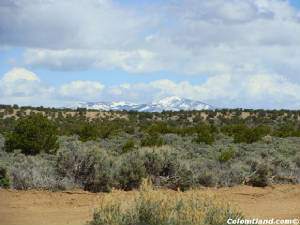
| More snow-capped mountains seen from lot |
|
| Click for larger picture |
|
| Plat map |
|
|
| Click for a larger picture |
|
|
| |
|
| |
|
| |
|
| |
|
Wooded Properties South East of Fort Garland, CO Lots for vacation homes, log cabins, travel trailer or RV. Reasonably priced Colorado Real Estate with owner financing.
|